Date: Wed, 07 Jun 2006 15:30:30 +0930
Hi there, I'd like to add a layer to my OpenMap application to display
contour data exported by DTRA's OpenMap-based HPAC tool. I do not have
source code access to the HPAC OpenMap code (though I understand that
the designers have made every effort to allow their work to be easily
usable in other applications).
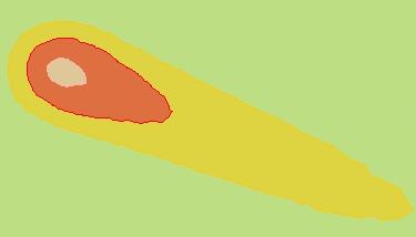
The information to display looks like some (occasionally complex and non
contigous) coloured, alpha'ed contours on a layer (simple sample attached).
After batting my head against this for a bit, I thought I'd post here to
see what you think... perhaps someone has tried this before.
The exported data formats available are roughly:
--
1. ESRI Shapefile (.shp)
- shapefile plus spatial index.
- associated ".cxl" file contain all necessary info to create contour
info - colours etc.
- includes info on the projection as a separate file
- database file (per the shapefile standard) has some info - though not
specific to colours and rendering of contours
2. FBV Overlay xml (.xml)
- All required info for coloured display gainst a DTD called "magic.dtd".
3. GALE tab 37 file
4. EIS Plume file (.lpm)
5. CTS Overlay (.asc)
6. ARCVIEW overlay (.arc)
7. HPAC overlay (.ovl), Model Output Data (.mod), Model Output (.mof)
- each of these last 3 file formats include everything you need to draw
pretty coloured contours
--
Of these, its easy enough to import a shapefile into my app - though the
OpenMap standard shapefile doesn't pick up the colour info for the
contours (which is what I am after).
The OpenMap FAQ similarly says "no" to ARC files - and the other formats
do not seem to have openmap support. FBV, EIS and CTS seem not to be
mentioned: even in these mailing list archives for example.
So I think I need to either:
- extend the current OpenMap shapefile to read the contour info in the
".cxl" file and modify how this renders to fill the shapes,
- write a custom layer to parse one of the HPAC format files (option 7
above) and display, or
- add the appropriate HPAC client jars to my classpath and include an
appropriate contour drawing layer and properties in my openmap.props
(any ideas on what this layer would be could be very useful!!)
So, if you have any suggestions or insight, I'd very much appreciate
some advice. I'm guessing that some of the list users may have solved a
similar problem...
Thanks and regards,
   matt
--
-- Matt Brennan || classForge Pty Ltd || 0403 355 602
--
--
[To unsubscribe to this list send an email to "majdart_at_bbn.com"
with the following text in the BODY of the message "unsubscribe openmap-users"]
(image/jpeg attachment: contour.jpeg)