Date: Mon, 28 Aug 2006 12:14:44 -0400
I am using a ImageServer to generate map images. I am getting unwanted graticules only on my land regions. Does anyone know what may be causing this to happen? I have attached a sample image and my openmap.properties file. Thanks.
Philip V. Monte
Software Engineer
Code 2514, Warfare Interoperability Branch
NAVSEA Warfare Centers Division Newport
--
[To unsubscribe to this list send an email to "majdart_at_bbn.com"
with the following text in the BODY of the message "unsubscribe openmap-users"]
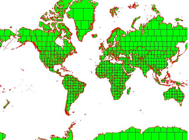
(image/jpeg attachment: map.JPG)
- application/octet-stream attachment: openmap.properties